6 DAYS MOUNT KILIMANJARO RONGAI ROUTE
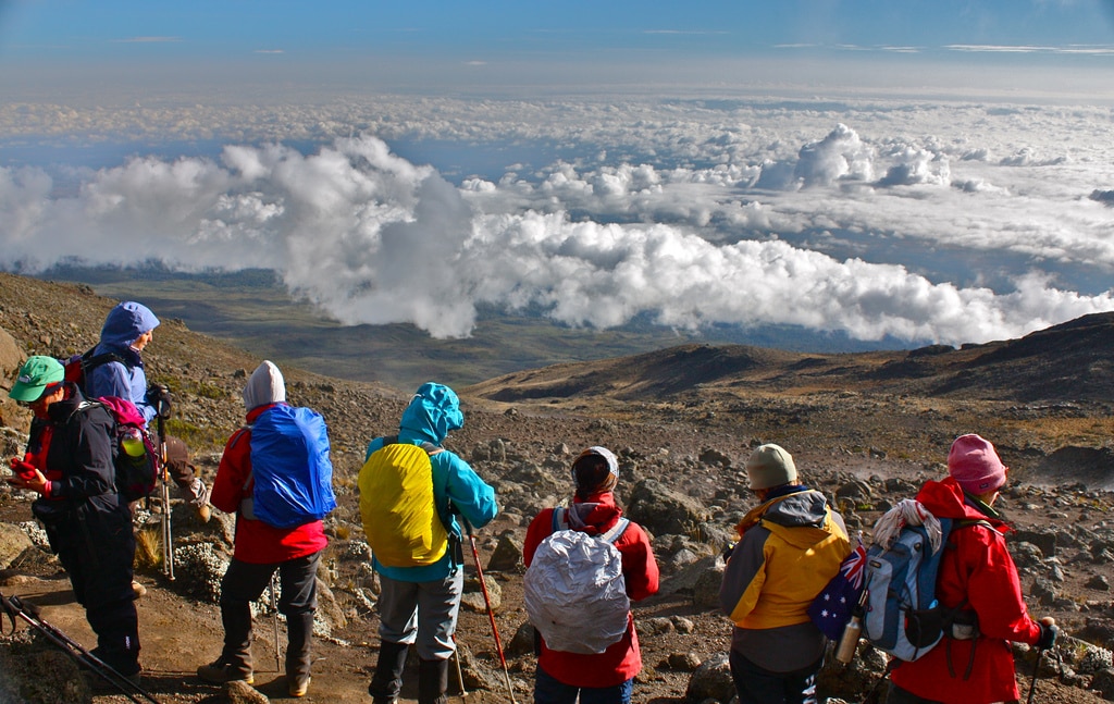
Rongai route begins in the northern side of Kilimanjaro Mountain, 45km from Moshi town or 69km from Arusha. Rongai is stated to be one of the most beautiful routes that start from the Northern side, In comparison to others this is the easiest route and its popularity has been increasing tremendously over the years. The route host a variety of spectacular landscapes together with different plants and animal’s species which make it one of the best sought after route of the Northern side. The typical duration for this trip is 6 days. But mostly the hikers prefer to take one day more, i.e., the 7 days to make the success rate higher. Rongai is scenically more beautiful than that of Marangu, and the difference is that when Marangu offers the hut facilities, the Rongai offers the tents to rest and make the overnight stay. At the end of each day you would find your tents pitched by the porters.
This route starts on the north side of the mountain just south of the Kenyan border and is one of the least traveled routes. The route merges with the Marangu for the summit climb. The descend follows the Marangu route on the mountain’s southeast side, so you will be able to Kilimanjaro from many points. There are two versions of this trek- a direct 6 day itinerary and a 7 day itinerary that takes a longer route. You can choose to attempt the summit via Mawezi Tarn Hut or via School Hut which is also referred to as the Outward Bound Hut. The former is longer and more popular. Prior acclimatization is suggested in order to attempt the latter successfully.
Details
Elevation: 1997m/6552ft to 2635m/8645ft
Altitude gained: 638m
Departing from Moshi a 4-5 hour drive will take you through the coffee plantations and Village of Nale Muru to the Kilimanjaro National Park Gate. We will patiently wait for our permits to be issued while watching the hustle and bustle of operations as many crews prepare for the journey ahead Enjoy the beautiful wooded scenery, and windy trails while your guide tells you about the local flora and fauna and natural wildlife you are likely to see. Simba camp sits near the first cave at the edge of the moorland zone with spectacular views of the plains of Kenya.
Elevation: 2635m/8645ft to 3487m/11,440ft
Altitude gained: 852m
After a good night sleep and a hearty breakfast we continue along moorland terrain on a consistent ascending path. You will catch some terrific views of Kibo and get your first glimpse of the ice fields on the Eastern crater rim. The small shrubs of the moorland became thinner as you approve the Second Cave. Temperatures begin to drop.
Elevation: 2635m/8645ft to 3936m/12,913ft
Altitude gained: 449m
After breakfast and packing, you continue your stead ascent, entering into the semi-desert terrain. This relatively short hiking day brings you closer to the Easter ice fields, continually drawing your attention to their beauty. Pay attention to your body and keep your guide informed of any signs of altitude sickness.
Elevation: 3936m/12,913ft to 5174m/16975ft
Altitude gained: 1238m
As you depart early the semi-desert zone from the Third Cave early in the morning and begin your trek into the Alpine Desert terrain for the remainder of your ascent. Today’s hike will take you just below the Kibo crater wall to the Kibo Huts. At this point, you will merge with the Marangu Route, which you will use to hike to the summit. You will prepare your clothing and equipment (replace batteries for headlamp and camera) before you go to bed by 7 PM and try to catch a few hours of rest before your summit attempt.
Elevation: 5174m/16975ft to 5895m/19,341ft
Altitude gained: 721m
Descent to 3721m/12,208ft
Altitude lost: 2174m
Excitement is building as morning comes with an early start between midnight and 2 a.m. This is the most mentally and physically challenging portion of the trek.
We continue our way to the summit between the Rebmann and Ratzel glaciers trying to stay warm and focused of the amazing sense of accomplishment that lies ahead. With a switchback motion in a northwesterly direction and ascend through heavy scree towards Stella Point on the crater rim. You will be rewarded with the most magnificent sunrise during your short rest here. Faster hikers may view the sunrise from the summit. From here on your remaining 1 hour ascent to Uhuru Peak, you are likely to encounter snow all the way.
Congratulations, one step at a time you have now reached Uhuru Peak the highest point on Mount Kilimanjaro and the entire continent of Africa!
After photos, celebrations and maybe a few tears of joy we take a few moments to enjoy this incredible accomplishment. We begin our steep descent down to Mweka Camp, stopping at Barafu for lunch and a very brief rest. We strongly recommend gaiters and trekking poles for uncooperative loose gravel and volcano ash terrain. Well-deserved rest awaits you to enjoy your last evening on the mountain. Overnight Mweka Camp.
Elevation: 3721m/12,208ft to 1905m/6250ft
Altitude lost: 1816m
After breakfast and a heartfelt ceremony of appreciation and team bonding with your crew it’s time to say goodbye. We continue the descent down stopping at the Mandara Huts for lunch. Remember to tip your guides, cooks, and porters, since you will be leaving them here. You return back to the Marangu Park Gate and receive your summit certificates. As the weather is drastically warmer, the terrain is wet, muddy and steep and we highly recommend Gaiters and trekking poles. From the gate, a vehicle will meet you to drive you back to your hotel in Moshi (about 45 minutes). Enjoy a long over due hot shower, dinner and celebrations!!
No Review
Accommodation0
Transport0
Comfort0
Hospitality0
Food0